My next book will be called 'The Park Falls Line.' This was the Omaha Railway branchline track from Tuscobia, north of Rice Lake, to Park Falls. The branch was abandoned in 1965 and is now an ATV Trail called the Tuscobia Trail. I have wanted to see this former trackage for years and finally got a chance on Thursday, June 28, 2018.
These are the signs at the trailhead in Tuscobia. This section of the trail, from Tuscobia to Birchwood, is restricted to walking and bicycles.
Friend Dan Morris has two 4-wheelers and offered to let me use one. And he grew up in Radisson, located on the line, so he was anxious to ride the trail also. (He had an engine cab ride on part of the line in his youth!)
The first location I wanted to see was Wooddale (note misspelling on the sign). This was the location of a log loading siding and even had a boxcar depot, which wasn't abandoned until 1952. There is absolutely no sign of the siding as foliage has taken over.
We found water covering the trail, maybe due to a beaver dam? No problem for our ATVs.
Next location is Yarnell. Again, a log loading siding with a stockyard and a carbody depot. No trace remains.
Lemington is the spot where the Omaha Railway crossed the Wisconsin Central, later Soo Line, now Canadian National track on a trestle.
With the removal of the track and formation of the trail, the trestle was removed. CN trains cross this location at speeds up to 60 MPH but none came through as we passed due to track tie replacement just north of this location. This is what it looks like today from the south.
And from the north.
Couderay is the next railroad location we came to. Here a train crosses the Couderay River just east of Couderay.
And a couple of shots from the bridge today.
Here is a picture of the village of Couderay when it was an active railroad town.
And here is what it looks like today!
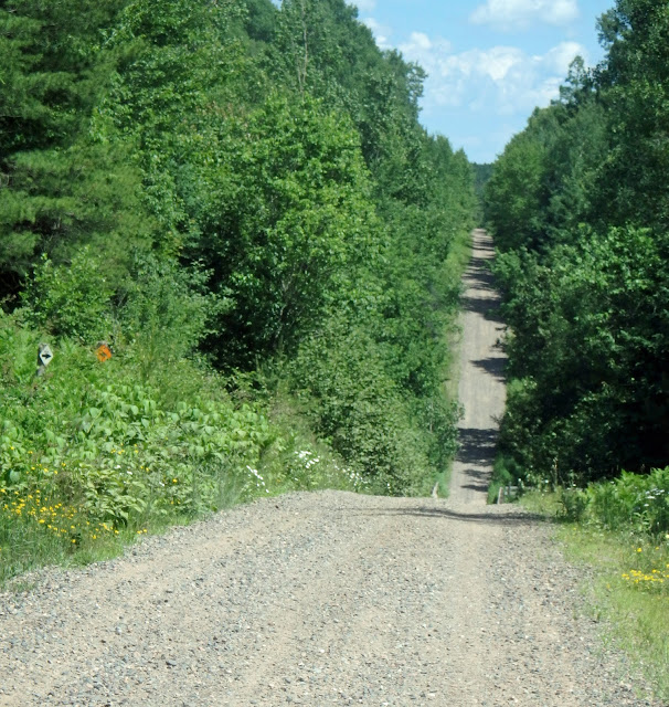
Even though temperatures were in the 80s, it was a beautiful day for a ride. Much of the trail is in the shadows due to trees growing in the right-of-way. And our movement prevented any mosquito or horse fly attacks! Here's a few shots from the shadow sections.
We saw some wildlife. Here is a doe with two yearlings. They never flinched as we passed as they were enjoying the cool water.
And who would have expected peacocks on the trail?? (There was a hobby farm next to the trail with lots more of these fowl). I also saw ruffed grouse and wild turkeys but no pix.
And there were beavers, which we didn't see. Here is one of their dams.
Which backed up water, flooding this swamp right up to the trail. I'm sure this section is flooded during rainstorms.
More wildlife habitat:
Wild flowers abound at this time of year.

Rivers and creeks are always fun to cross. Here is the Brunet River:
And we crossed the Chippewa River:
The bridge piers from the original railroad bridge at this location still remain:
I didn't get the name of this creek!!!
And a creek leading to a large swamp:
Radisson was the next village we came to.
And then Ojibwa. There isn't any sign of the railroad here today.
At Winter, we find the only remaining depot of this rail line. It has been moved and is being restored.
Loretta and Draper are only one mile apart, both on Highway 70. When Loretta developed, the railroad didn't want two depots so close together so they moved the Draper depot to Loretta. Today, except for the trail, you wouldn't know these at one time were large logging towns.
Here's Loretta:
And here is Draper, looking north:
And looking south:
I was eager to see Kennedy and Kaiser, former logging towns and from what I've read, have now completely disappeared. There was no sign of Kennedy. I thought there would be a trail marker but nope. But, just east of what I think was the location of Kennedy, we found this huge ravine. This must have been spanned by a very large timber trestle. Would I like to get a picture of that for the book!! First picture, looking north or east:
And looking south, or west:
Unfortunately, the trail was blocked about seven miles from Park Falls, probably due to flooding. So we didn't find Kaiser. I really wanted to see this section as it took the railroad about two years to complete this last section due to very rough terrain and I wanted to see it!! Maybe another trip later . . . . So we turned around and headed back. We covered about 120 miles in 10.5 hours, six hours up and 4.5 miles back.
Thanks to Dan Morris for taking me on this adventure!!


